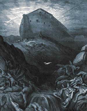
Question:Is there or is there not direct evidence that what is today known as “Mt. Ararat” was at one time underwater? If not, is it possible that there was rapid mountain-building in the *wake* of the Flood, such that some of the resulting mountains would not themselves have been submerged…?
Thanks, Andy
Answer:The Bible does not mention a “mount” Ararat in the singular sense, but the “mountains” of Ararat. And the “mountains of Ararat” are equivalent to the “mountains of Armenia” according to some scholars of ancient Hebrew. And if the term is not equivalent to all the mountains of Armenia, it is still equivalent to a very wide area:
“Genesis says that the Ark landed on the ‘mountains of Ararat,’ where ‘Ararat’ is not a single mountain but a region [2 Kings 19:37, Isa 37:38, Jer. 51:27]. That region, known in Assyrian records as Urartu, is, roughly, bounded on the west by the Euphrates River, on the south by the western Taurus Mountains (northern Iraq), somewhat east of Lake Urmia, and north to include the plain of the Araxes River. ‘The mountains of Ararat’ implies not a single peak, but a mountainous region within this area, such as the Qardu region (northern Kurdistan) west of Lake Urmia. Early reports of the ark place it on several different mountains, including some in the Qardu region. ‘Mt. Ararat’ is not mentioned as a landing site until the 11th or 12th century.” [references given further below]
I do not know the precise geology of Mt. Ararat. But I was able to dig up plenty of information to help answer your question by using the search terms: geology Mt. Ararat volcano*. I plugged those search terms into the handy smaller number of google search sites that are arranged together. Afterwards I went back and search all of the web using the above search terms, just to check for any relevant statements I had missed. Here is what I googled up, quite a lot actually:
John Morris (an officer and a “full professor of geology” at the Institute for Creation Research) believes humans and dinosaurs once coexisted, and that dragons were in fact dinosaurs. During a debate on the television show, “AM Indiana,” Morris stated that “Alexander the Great has a very sober history of an encounter with a dragon, and most of the historians of the day list dragons as if they were real.” Unfortunately for Morris, no writings of Alexander have survived. The historians Plutarch and Arrian quote from alleged letters of Alexander, but the letters do not tell of any meeting with a dragon.
Morris was then asked for details about the fossiliferous sedimentary rocks which, in his book “The Ark on Ararat”, he had (falsely) claimed had been found near the top of Mt. Ararat, and were proof that this volcanic peak had once been under water. To his opponentʼs great astonishment, Morris denied that he had ever written such a thing: “I have never said that those fossils were on top of Mt. Ararat. Those fossils are IN SIGHT OF Mt. Ararat.” I reported that in 1969 a glaciologist claimed he found a fossil layer about the 14,000-foot level. The fossil layers that IʼVE studied are some ten miles away.”
Morrisʼs denial was false. On pages 10 and 11 of “The Ark on Ararat” — written by Morris and the preacher Tim LaHaye, and issued in 1976 by Thomas Nelson, Inc. — we find:
“A great deal of evidence exists indicating that not only was Mt. Ararat once covered by water, but it even erupted while submerged under great depths of water. In common with many mountains around the world, Mt. Ararat exhibits fossil-bearing strata. Sedimentary rock (by definition laid down by flood [sic] waters) containing the fossilized remains of ocean creatures has been found as high as the snow line, approximately a 14,000-foot elevation. Furthermore, on the exposed northeastern face, layers of lava are intermingled with layers of sediments.”
When confronted with the passage, Morris replied that the discovery was the work of the creationist Clifford Burdick and had been described in the “Creation Research Society Quarterly.” According to Morris, Burdick:
“Conducted a rather extensive geologic survey over the space of several summers. He not only has written that he discovered fossil-bearing strata, on the west flank of Mt. Ararat, but he has told me so personally…
The discovery was included not only in Burdickʼs CRSQ articles, but also in the official report by the Archaeological Research Foundation to the Turkish Government, resulting from their expeditions in the 1960ʼs. However, no where in Burdickʼs article: “Ararat — the Mother of Mountains,” (which appeared in the “Creation Research Society Quarterly,” June, 1967
Did the author claim that there were fossiliferous, sedimentary layers on Mt. Ararat. He simply gave a list of fossils found in 1845 by one H. Abich, in sedimentary rocks that were at least ten miles from Ararat.
Same Story As Above, But Told By The Person Who Debated John Morris
I can mention an incident that arose early in 1989, while debating John Morris, the Noahʼs Ark “expert.” We were on the Dick Wolfsie show, “AM Indiana,” on Channel 13 in Indianapolis. For one fast-paced hour, we argued furiously over the question, Did Noahʼs flood ever occur? Very early in the show I asked Morris for details about the fossiliferous sedimentary rocks which, in his book The Ark On Ararat, he had claimed existed on Mt. Ararat. [1] I noted that more than a year earlier I had written to John for details, but my letter had never been answered. “Just what kind of sedimentary rocks were these on the top of Mt. Ararat,” I asked, “and what fossils were in them?”
At first, accepting my premise that such a claim was to be found in his book, he simply gave the vague answer, “The fossils were shells.” When asked to be more specific, he replied, “Dated as Cretaceous sorts of things, supposedly on the order of a hundred million years or so old. Now, I donʼt buy the date, but thatʼs the normal conventional date for it.” Without a doubt, at this stage in the debate Morris knew that in his book he had published the claim that fossiliferous rocks could be found on Mt. Ararat.
Less than a minute later, however, Morris made the startling assertion that he had never claimed there were fossils on Mt. Ararat:
In this subject, I have never said that those fossils were on top of Mt. Ararat. Those fossils are in sight of Mt. Ararat…I reported that in 1969 a glaciologist claimed he found a fossil layer about the 14,000-foot level. The fossil layers that Iʼve studied are some ten miles away. In point of fact, although Morris had mentioned sedimentary rocks in the vicinity of Mt. Ararat (hence the partial agreement in my last line), he had made no mention of any glaciologist, and he had written that fossiliferous rocks were to be found on the volcano. If he had not made so absurd a claim, I would not have written to him the year before!
On pages 10 and 11 of The Ark on Ararat, a book co-authored with Tim F. LaHaye, we find the following claim:
A great deal of evidence exists indicating that not only was Mt. Ararat once covered by water, but it even erupted while submerged under great depths of water. In common with many mountains around the world, Mt. Ararat exhibits fossil-bearing strata. Sedimentary rock (by definition laid down by flood waters) containing the fossilized remains of ocean creatures has been found as high as the snow line, approximately a 14,000-foot elevation. Furthermore, on the exposed northeastern face, layers of lava are intermingled with layers of sediments. [2]
Readers will note that although LaHaye and Morris do not know how to define ‘sedimentary rock’ correctly, they do claim that such is to be found on Mt. Ararat! Nowhere in the vicinity of the passage quoted above is there any mention of a glaciologist or the year 1969, nor is there any hint that the claim of fossiliferous rocks on Ararat is in any way discordant with the views of the authors. The annoying part of all this is the fact that Morrisʼ denial of his fossiliferous rock claim was part of an attempt to show that it was I who was dishonest - that I was misrepresenting creationist claims and arguments:
Frank, let me say that if youʼre going to be critiquing my book, or if youʼre going to be critiquing the Bible, which I do believe, what you need to do is handle that [sic] data honestly. Now what you just have said is not what I wrote in that book!
The final result of this attempt to make me look like a liar was a report in the April, 1989, issue of Acts and Facts, a propaganda organ of the San Diego-based Institute for Creation Research (ICR). In that scrupulously subjective journal it was reported that Morris was able to provide answers to all his [Zindlerʼs] substantive charges, while exposing his use of unfair caricatures and “strawmen arguments.”
One of the “strawman arguments” of which I was guilty was, without doubt, my correct claim that Morris had written about fossils on Ararat! After the debate, I photocopied pages 10 and 11 of Ark on Ararat and sent them to Morris, to let him know that I had seen through his denials during the debate - even if no one else would ever know that what he had said on television was untrue. A short time later, Morris sent me a letter in reply. By then, he seemed to have forgotten just what it was that had been in dispute: whether or not he had ever written that there were fossiliferous rocks on Mt. Ararat. Instead, he tacitly admitted that such a claim was in his book, but tried to get off the hook by attributing the “discovery” to a fellow creationist, Clifford Burdick:
You will notice that in this whole section I am summarizing, in particular, the work of Dr. Burdick, who conducted a rather extensive geologic survey over the space of several summers. He not only has written that he discovered fossil-bearing strata, on the west flank of Mt. Ararat, but he has told me so personally, as have Dr. Lawrence Hewitt and Eryl Cummings…
As you should well know, it is most proper for one scientist to quote from or refer to the work of others, refuting it or challenging it only when there is clear evidence of a mistake. I have no such clear evidence, and knowing most of the men referred to above, I am inclined to believe their evaluation…
Again, the question was not who claimed to have found the rocks, but rather, did Morrisʼ book claim that there were sedimentary rocks on Mt. Ararat? Although most people would simply chalk up this episode as but one more instance of a creationist lying through his teeth on television, Morrisʼ behavior probably is better explained as the result of disordered processes of moral and logical reasoning. Since he knew - even though no one else could know it - that Burdick was the original author of the sedimentary rock claim, Morris apparently felt he could deny having claimed it himself: his published claim was really Clifford Burdickʼs claim!
Notes
[1] Mt. Ararat is a dormant volcano, composed entirely of igneous rocks.
If it could be shown that it had sedimentary rocks on top of it, it could be argued that the volcano had once been under water - Noahʼs flood, even!
[2] Tim F. LaHaye and John D. Morris, The Ark on Ararat, (Nashville: Thomas Nelson, Inc., 1976), pp. 10-11.
The entire transcript of the discussion between YEC John Morris and Frank Zindler, along with notes.
The Geology Of Mt. Ararat
[The mountain which today is known by some as “Mount Ararat,” is] an extinct volcanic massif.[110] [In fact it is] a type of volcano called a stratovolcano, like Mt. St. Helens and Mt. Vesuvius. A stratovolcano is built by a series of eruptions of ash, cinders, and lava into a layer-cake structure, usually over a period of at least several hundred thousand years. A typical eruption starts with fine-grained ash, grades into coarse pyroclastic flow deposits, and ends with a lava flow. Mount Ararat has been found by geological means to have begun erupting about two million years ago.[111]
A stratovolcano cannot form underwater, because the water quenches the normal ash flow and forms distinctive lava formations called pillow lava. Pillow lava forms when water rapidly chills the outside of a lava flow, forming pillow-like segments. If an incipient volcano, which would have formed a stratovolcano on land, erupts underwater, it forms a structure quite different from that which would have formed on land. It forms a large pile of pillow-lava, like those formed at mid-ocean ridges, and no ash or pyroclastic deposits.[112] Mount Araratʼs structure shows it formed on land.
Interestingly, pillow lava has been found on Mount Ararat, but only in small patches. It can form when lava erupts underneath a glacier, or flows into a lake on the mountain. In Iceland, large mountains of pillow lava formed underneath the glaciers of the last ice age, and can be seen today. [The young-earth creationist] articleʼs writer gives credence to the claim that Noahʼs ark may rest on Mount Ararat. In doing so he is forced to admit that Mount Ararat formed before or during the Flood — otherwise the ark could not come to rest upon it. But the geology of the mountain shows it did not form underwater. Therefore it must have existed before the Flood. But this contradicts the [young-earth creationist] claim that the Flood was not more than 9000 feet deep [113], since Ararat is nearly 17,000 feet high. If the Flood was deeper than can be accounted for by all the water on earth today, we are back to the question, Where did the extra water go? The writer is unaware of these difficulties.
Given that one cannot logically believe two contradictory things at one time, what is the [YEC] position on these questions? Was the Flood deep enough to cover Mount Ararat at 17,000 feet, or do [YECs] believe that Noahʼs ark rests on the mountain?
Notes
[110] The New Encyclopedia Britannica, Micropedia, Vol. 1, p. 518, 1991.
[111] John Warwick Montgomery, The Quest For Noahʼs Ark, p. 227, Bethany Fellowship, Inc., Minneapolis, Minnesota, 1972. A fairly reasonable account of many searches on Mount Ararat for Noahʼs ark. Uncritically accepts much hearsay evidence, and omits evidence contrary to the authorʼs belief that the ark is on Ararat.
[112] Fred M. Bullard, Volcanoes in History, in Theory, in Eruption, pp. 248-249, University of Texas Press, 1962.
[113] 1993 International Creation Conference in Beaverton, Oregon …I asked Parker [an ICR creationist] what he thought about last weekʼs program about Noahʼs Ark on CBS television. He said he hadnʼt seen it. I asked what the relationship of the ICR was to that program, and he said essentially that they were independent. I asked him about a couple of anomalies in the CBS program. It had claimed that Noahʼs Flood was about 9000 feet deep, which Parker agreed with. I pointed out that this implied that all mountains, including Ararat, must have been less than 9000 feet high, while the Ark had been claimed to have been at around 12-13,000 feet on Mount Ararat. He had no answer for that, except that there were many different people responsible for the programʼs content. Then I pointed out that the Flood geology scenario says that land and ocean bottoms must have been at equal depths during the Flood, which he agreed to, but that this created a problem with the Hawaiian Island - Emperor Seamount chain — in particular the big island of Hawaii, which is 30,000 feet high from the base and would therefore stick 21,000 feet above the Flood water. We concluded from this that the Hawaiian chain must have formed after Noahʼs Flood. I then asked him if he really thought it possible that Hawaii formed after the Flood, seeing as how the rest of the islands are deeply eroded and become more so the farther west you go, and in fact dive under the surface to become seamounts. He saw no problem in any of this, saying that it was quite possible for large mountains like Hawaii to form in well under 4000 years.
The Jehovahʼs Witnesses seem to be in agreement with Parker of ICR above, that the Flood waters were less than 8000-9000 feet deep:
The writer of the Watchtower [A Jehovahʼs Witness publication] article “The Unforgettable Flood” seems to have forgotten about the shallow depth of the Flood, less than 8000 feet, implied in prior Watchtower publications. On page 3 he says:
Five months after the Deluge began, the ark came to rest on the mountains of Ararat, situated in present-day eastern Turkey…. Since the 19th century, there have been numerous attempts to find the ark on the mountains of Ararat. These mountains have two prominent peaks, one 16,950 feet high and the other 12,840 feet.
Ararat Report #32, May 1993 [Published by Christian Information Ministries, 2050 N. Collins, Suite 100, Richardson, TX 75080, 972-690-1975 [email protected] ]
Figment or fact? The Incredible Discovery of Noahʼs Ark World Premier Showing: CBS Network February 20, 1993. Produced by Sun International Pictures. 1993. Executive Producer: Charles Sellier, Jr. Chief Researcher: Dave Balsiger Host: Darren McGavin
…To make a solid case for Mt. Ararat as the final resting place of Noahʼs Ark, it seems to us that it would be absolutely essential to have some proof that it was once submerged. The makers of the documentary apparently shared this concern. The evidence given however, is far from conclusive. An unidentified person is shown exhibiting a huge chunk of sea salt.12 The narrator then intones that large deposits of sea salt have been found on the mountain as well as pillow lava. If both are true it would seem like an air-tight case. The facts, however, are different than presented. To our knowledge, no sea salt has been found on the mountain, and the purported pillow lava is at best, debatable. Geologists who have seen it are doubtful, but do admit that it could be. One then has to ask: are these rocks the result of the extrusion of lava into water or snow? We think it is unlikely, since there are no other unassailable arguments that the mountain was ever under water. For instance, there are neither water formed sediments or fossiliforous rocks on the mountain that we are aware of.13 Those who are searching for the Ark on Ararat need to explain this glaring deficiency. When we broach this problem with Ark hunters, the general reaction is: “How can you be so skeptical when we have all these eyewitness accounts?”
Notes
12.This footage is from the earlier movie and must be Dr. Clifford Burdick. In Burdickʼs geological report of 1967 of the Ararat area he mentions a large deposit of sea salt discovered about 50 miles away (see “Ararat: The Mother of Mountains.” in Creation Research Society Journal, 1967, pp. 9,10.
13. Morris, in his book, The Ark on Ararat, (p.11) reports that fossils and sedimentation are found on Ararat. We are unaware of the documentation for this claim. There is sedimentation on Ararat, but it is the result of vulcanism and not hydraulic action.
There seems to be almost a total lack of evidence this mountain [Mt. Ararat] was ever under water… [Creationist] and early Ark searcher, Clifford Burdick, claimed to have found pillow lava on the mountain as well as sedimentation. Neither claim can be substantiated. The sedimentation he found was instead laid down by volcanic action and not by water.
“[I collected] a bit of andesite from volcanic Mt. Ararat, so I can hurl it at any fundy who claims that the lavas of the mount are pillow basalts (andesite is not basalt and only submarine basalt forms pillow structures.)”
— Marty Leipzig
“There is absolutely no concrete evidence to show that this mountain was once submerged. If it was, one should be able to find large amounts of sea salts, pillow lava, water-formed sediments, and/or fossiliforous rocks. Only pillow lava is reported to be on the mountain. However, geologists have not performed an exhaustive study of these formations, and many experts claim that it is not pillow lava at all.”
A Christian who believes in Noahʼs ark admits: “Mt. Ararat (so named in AD 1105) shows no evidence of ever being under water— no marine fossils, no pillow lava, no flood-produced sedimentation.”
What Would We Expect To Find If The World Had Flooded?
— Igneous (volcanic) rocks, if they existed at all in flood sediments, would all be in the form of pillow lava, which are extruded underwater. There could be no segregation of igneous rock types. Basalt would be the only igneous rock type because all activity would have been extrusive. There would be a complete absence of volcanic layers within the strata.
In reality, there are very clearly defined volcanic layers, from which radiometric dates are obtained. How can we observe layers of volcanic rock within the strata if there was a Flood at at the time? The lava would have mushroomed up into what is known as “pillow lava”, like we see on the ocean floor today. So how can we have flat layers of volcanic rock, compressed between other layers, occuring during an “ultramassive flood”?
Another Christian who believes in Noahʼs ark admits: “The Bible does not even specify a particular mountain. Having studied Mt. Ararat and the surrounding area, one of intense geologic and volcanic turmoil, I have concluded that a wooden structure such as the Ark would not be likely to survive if it had landed there.”
“Massive volcanic outpourings have resurfaced large portions of Kurdistan in the north and Northeast. The greater and lesser Ararat peaks, as well as Mt. Nimrod (or Nimrut Dâgh) on the shores of Lake Vân, are three prominent results of this active geology.”
Geological, agricultural and biological diversity of Armenia
The Republic of Armenia is situated in the southern part of the Caucasus between watersheds of middle streams of the Araks and Kura Rivers. The territory of the Republic is 29,800 sq. kilometers. It occupies the southern part of a vast highland area known as Armenian Upland, which is located within the Alpine-Himalayan mountain system. The average elevation of the Armenian Upland is 1,800 meters above sea level. Ancient geographers called the Armenian Upland the “Mountain Island” or the “Roof of Asia Minor.” In the structure of mountain ridges extinct volcanoes play an essential role. Their activity left its mark on Armenian nature. In the Armenian Upland eruptions of volcanoes have occurred relatively recently, before eyewitnesses. The last eruption of the Nemrud volcano on the eastern shore of Lake Van (Eastern Anatolia) was in 1441. Biblical Mount Ararat dominates the Armenian Upland. It is isolated from the ridges and plateaus and rises above the surrounding plains for more than 4 kilometers. The massif consists of two extinct volcanoes - Great Ararat (Masis), having a height of 5,165 meters, and Little Ararat (Sis), at 3925 meters. Their peaks are located at a distance of 10 kilometers from each other. Ararat is amazingly beautiful. It has attracted travelers since ancient times.
Armenia is one of those rare countries that, though small in territory, is notable for its complexity and rich diversity of its geological structures. In a small area one can observe various signs of active geological processes ever taking place on the earth and continuing today. These include strongly transformed metamorphic rocks of the Pre-Cambrian basement and nearly “fresh” lava flows of recent volcanoes; thick layers sedimentary, volcanogenic-sedimentary and volcanogenic deposits of sea, deep- sea- rift, lacustrine - continental basins, and products of magmatic activity, including volcanic activity from the Middle Paleozoic up to the Quaternary Age; the results of the complicated tectonic processes that took place in the remote geological past, and signs of the contemporary tectonics. To the above series one can add numerous ore and nonferrous deposits, sweet, thermal and mineral springs, as well as rare mineral associations and interesting results of contemporary abrasion and erosion processes.
Source: geocities.com/sutlik/agr.htm
A third of [all the] sporadic [volcanic] activity [in the world] extends from Armenia in eastern Turkey eastward through the Central Volcanic Belt of Iran (Boccaletti et al., 1977). This region is located mainly within a zone of intense lithospheric crushing where the Arabian Plate is moving northeast against the Eurasian Plate (see Plate T-39). On the west and east sides of the point of convergence near Lake Van are two other plates, the Anatolian and the Iranian, which are considered microplates by some tectonicists. The Anatolian Plate is being squeezed westward along the North and East Anatolian transcurrent faults. Likewise, the Iranian Plate is being pushed to the southeast along similar faults that pass through the Elburz Mountains north of Tehran and through the suture (Main Recent Fault) of the Zagros Crush Zone. Some of this deformation began in Late Cretaceous/ Paleocene times, intensified in the Miocene/Pliocene, and continues unabated.
Lambert et al. (1974) studied the tectonic, petrologic, and geochemical setting of the region that encloses Mt. Ararat, a large stratocone (more than 35 km wide at ground base) near the corner at which Turkey, Iran, and Soviet Armenia meet. Here, in the aforementioned crush zone (considered a discrete microplate —the Van plate—by Dewey et al. (1973)), crustal shortening along a northeast line gives rise to a northwest tensional line of fractures that control volcanic emplacement. This group includes Nemrud at the west end of Lake Van, Suphan, Tendurek, and Ararat itself at the northeast end. The crush zone sits astride the intersection between east- west tectonic trends in Turkey and the northwest-southeast Zagros structures (Plate T-42). Dewey et al. (1973) and other investigators postulate consumption of the Arabian Plate along a subduction zone under the Van microplate. Lambert et al. (1974) and McKenzie (1972) point to the absence of intermediate to deep earthquakes as evidence against subduction today.
Highest of the northeast line of volcanoes is Ararat (Altinli, 1964). As seen (looking southward) from the ground (Figure V-17.1), Greater Ararat (right) at 5156 m towers above Little Ararat (3903 m) some 12 km to the east. Both peaks are evident in the thematic mapper subscene that constitutes Plate V-17. This unusual color rendition results from a combination of bands 1 (blue), 4 (green), and 7 (red). This effectively separates clouds above Greater Ararat from an ice cap (in blue), both of which appear white in visible wavelength images. Much of the lava and ash deposits along the slopes appears as a purplish-brown (as does some derivative Quaternary slope debris). Some of the younger basalts to the northeast take on a purplish-blue hue. Bright red markings superficially resemble fresh lava flows but are brush fire burn scars (bright in band 7). Older tuffs exposed in the Cehenna Gorge cut into the north flank are not recognizable, being largely in shadow, but still older volcanics to the west are rendered yellow-brown. The darker orange-brown along the upper slopes of Ararat results from the color mix related to bright returns from vegetation (forests) for band 4 and rock and vegetation for band 7. Especially distinctive in the image are lava channels and gutters; adventive cones and possibly domes may also be present on the slopes. Dissected volcanic terrain gives way to a plains along the Rizdan River to the north and to Devonian/Permian sedimentary rocks in mountains to the southeast.
Ararat is typical of the calc-alkaline volcanism that led to the expulsion of dacites and andesites in the region. Younger out-pourings consist of alkali basalts. Related volcanism extends eastward into northern Iran, culminating in the dormant Damavand (5671 m) volcano near Tehran. Another large stratovolcano, Sahand (3710 m) south of Tabriz, is prominent in the Landsat image shown as Figure V-17.2; a smaller volcanic structure, Shaki (2189 m), extends as a peninsula into Lake Urmia. Both show extensive slope erosion, forming barrancos or gorges that help to emphasize the pronounced radial drainage. This pattern is especially brought out in the SIR-A radar image of Sahand seen in Figure V-17.3. Landsat TM 50209-07140, September 9, 1984.
Source: daac.gsfc.nasa.gov
Descending From Mount Ararat
According to some creationists, Mt. Ararat in Turkey is the same “mountains of Ararat” mentioned in Genesis. If this is the case, one cannot help but be impressed by the agility of the arkʼs inhabitants. Mt. Ararat is actually a large volcanoe, extending over 5km above sea level.
Even experienced human climbers have found the trek difficult and dangerous. At this elevation, most animals would have found breathing difficult. Those that could breath would find getting down off of the mountain without breaking a leg even more difficult.
“It would have taken a special miracle to get Noah and his family down from such dizzy mountain heights where the cold would have been extreme.” (Ramm, Bernard.L. [Christian], The Christian View of Science and Scripture, 1955, p.162)
“Unfortunately, this still is not enough time for sloths to travel. Sloths shiver at 80 degrees F and to travel from Ararat to South America would require much shivering.” (Glenn R. Morton, Sun, 20 Sep 1998 16:39:36 -0500, American Scientific Affiliation archives on the web — The ASA is primarily an old-earth or theistic evolutionist organization though YEC Christians are also invited to join.)
Index to Creationist Claims
Claim CH501: We can expect to find Noahʼs Ark on Mt. Ararat.
Source: LaHaye, Tim and John Morris, 1976. The Ark on Ararat, Nashville: Thomas Nelson Inc. and Creation Life Publishers.
Response: Mt. Ararat (known locally as Agri Dagi) is very likely the wrong place to look. Genesis says only that the Ark landed on the mountains of Ararat, where Ararat is not a single mountain but a region [2 Kings 19:37, Isa 37:38, Jer. 51:27]. That region, known in Assyrian records as Urartu, is, roughly, bounded on the west by the Euphrates River, on the south by the western Taurus Mountains (northern Iraq), somewhat east of Lake Urmia, and north to include the plain of the Araxes River. “The mountains of Ararat” implies not a single peak, but a mountainous region within this area, such as the Qardu region (northern Kurdistan) west of Lake Urmia. Early reports of the ark place it on several different mountains, including some in the Qardu region. Mt. Ararat is not mentioned as a landing site until the 11th or 12th century. [Bailey 1989, 61-82]
No wooden structure, including the Ark, should be expected to survive intact after 4500 years. The weather on Ararat is harsh and changeable; it would have destroyed the Ark if it were exposed. Some people claim that the Ark could have survived in a glacier, protected by the covering ice, but this also is unlikely. First, the ice would have crushed the Ark.
Second, glaciers flow, carrying along whatever is inside them. Different parts often flow at different rates, which would deform the Ark. And the Ark started on the ground, so it would have been eroded as the glacier dragged it over the rocks.
References:
Bailey, 1989, see below.
Further Reading: Bailey, Lloyd, 1989. Noah: The Person and the Story in History and Tradition. Columbia: University of South Carolina Press.
For answers regarding Specific Ark “Sightings”
Most creationists accept a medieval Armenian tradition which identifies the arkʼs landing place (Mount Ararat) with the volcano Agri Dag in eastern Turkey. They recount alleged sightings there of remnants of the ark by everyone from local peasants to Russian aviators. The ICR and other creationist groups have mounted repeated expeditions to find the ark. On one of these expeditions, ex-astronaut James Irwin nearly died in an accidental fall; on another, ICRʼs John Morris was struck by lightning.
However, no one has ever presented authenticated photographs, fragments, or other hard evidence of the ark found on Agri Dag or elsewhere.
Dr. Howard M. Teeple, author of The Noahʼs Ark Nonsense, documented the movement in time and place of the earliest known “Flood” stories in the ancient Near East. He noted the storyʼs first appearance and compared its geographical location to later appearances. He concluded that the earliest known “Flood” story was discovered on clay tablets uncovered by archaeologists in Sumer/Babylon. Its next recorded appearance was found on clay tablets north of Sumer/Babylon. Afterwards a version of the tale appeared east, then south, and continued east till a version eventually appeared in ancient Greece. He added that each culture/civilization adapted the “Flood” story to suit themselves by changing the names of the people involved and which mountain the “boat” allegedly “landed on.” So the “Flood” story appears to have traveled like any story might be expected to have traveled, along trade routes in the ancient world. It originated in Sumer/Babylon (by the river Euphrates known for its floods) and only later reached the Hebrews (rather than being a story whose real truth was revealed solely to Moses in comparison to which every other culture only had cloudy memories).
Catastrophic flooding occurs in most areas of the world. However, if [flood] stories are gathered from around the world, one may be struck far more by the divergences than by their similarities. It is important that such collections have been gathered without regard for their support for a single universal flood. It would be easy to rule out those that sound dissimilar and then to be amazed at how similar the remainder are!
Although flood stories from around the world vary widely in their content, those from Syro-Palestine and Mesopotamia (the so-called lands of the Bible) are strikingly similar. While it is difficult, if not impossible, to believe that flood stories gathered from around the world descended from a single source (or describe a single event), the reverse may indeed be the case in the Ancient Near East. It is, after all, an area given to regular and catastrophic flooding, for which adequate archaeological and geological evidence has come to light. Furthermore, it is an area through which the story of “the flood” could easily spread: it is geographically
small and well defined (the so-called fertile crescent), its inhabitants spoke closely related Semitic languages, there was occasional political unity of the whole (under Assyrians, Babylonians, and Persians), and commerce was widespread throughout at all periods.
— Lloyd R. Bailey, Noah: The Person and the Story in History and Tradition
Statement by a Christian who is also an Old-Earth Geologist
Can anyone explain to me why creationists are not willing to listen to the clear arguments? Jack Haasʼ project is absolutely essential but will have an uphill struggle against invincible ignorance and pejorative definitions like “evolutionary geology.” I became a Christian a month before graduating in geology at Oxford University in 1968 through the IVF. If I had been confronted by Creationism I would have rejected the claims of Christ.
— Michael Roberts, 1/6/01 3:09 AM, M.B. Roberts
Statements from young-earth creationists at the website, “Answers in Genesis”
“We have never stated that any site, whether on the mountain [of Ararat] or off it, contains the remnants of the Ark [of Noah], nor have John Morris or ICR.”
In November 2001, Answers in Genesis published an article on its website entitled, Arguments we think creationists should NOT use which… covered a substantial number of widely-used arguments opposing evolution. It was meant to inform Christians why we felt these arguments were either factually incorrect, or were very dubious and unsafe, even counterproductive, to use… Some people became upset, expressing their dismay through phone calls, emails and the like… I had people complain to me at conferences. One man said: ‘Evolutionists have so much evidence; if you people at AiG keep destroying some of the greatest evidence weʼve had, thereʼll be none left for creationists. Youʼre helping the evolutionists win!’…
Many people… think that to oppose evolution or disprove an old earth, one has to come up with totally different or unique ‘evidence.’ I think this is a major reason why a number of Christians are drawn to what I call ‘flaky evidence’ in the hope that this will counteract evolution. For instance, such things as: A supposed boat-like structure in the Ararat region as evidence of Noahʼs Ark.
| Help Ed score 100% on YSlow. Server Fees & 🍪-free *CDN. This page was designed and tested by Night Owl using GTMetrix on 6/13/2017. | |||
| *Content Delivery Network | PageSpeed (100%) | YSlow (99%) | Onload Time 0.367s Fully Loaded Time 1.2s Pagespeed 100% YSlow 99% |